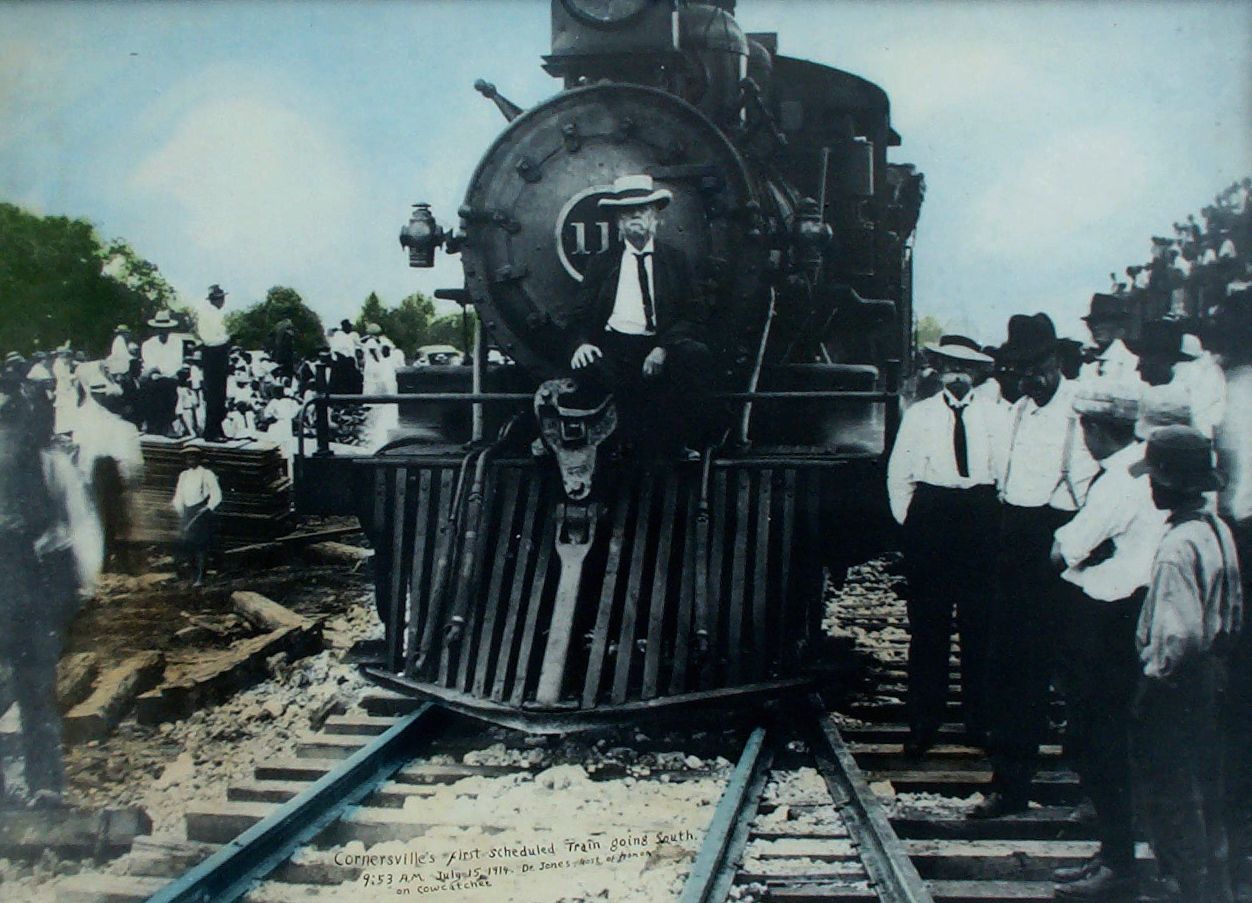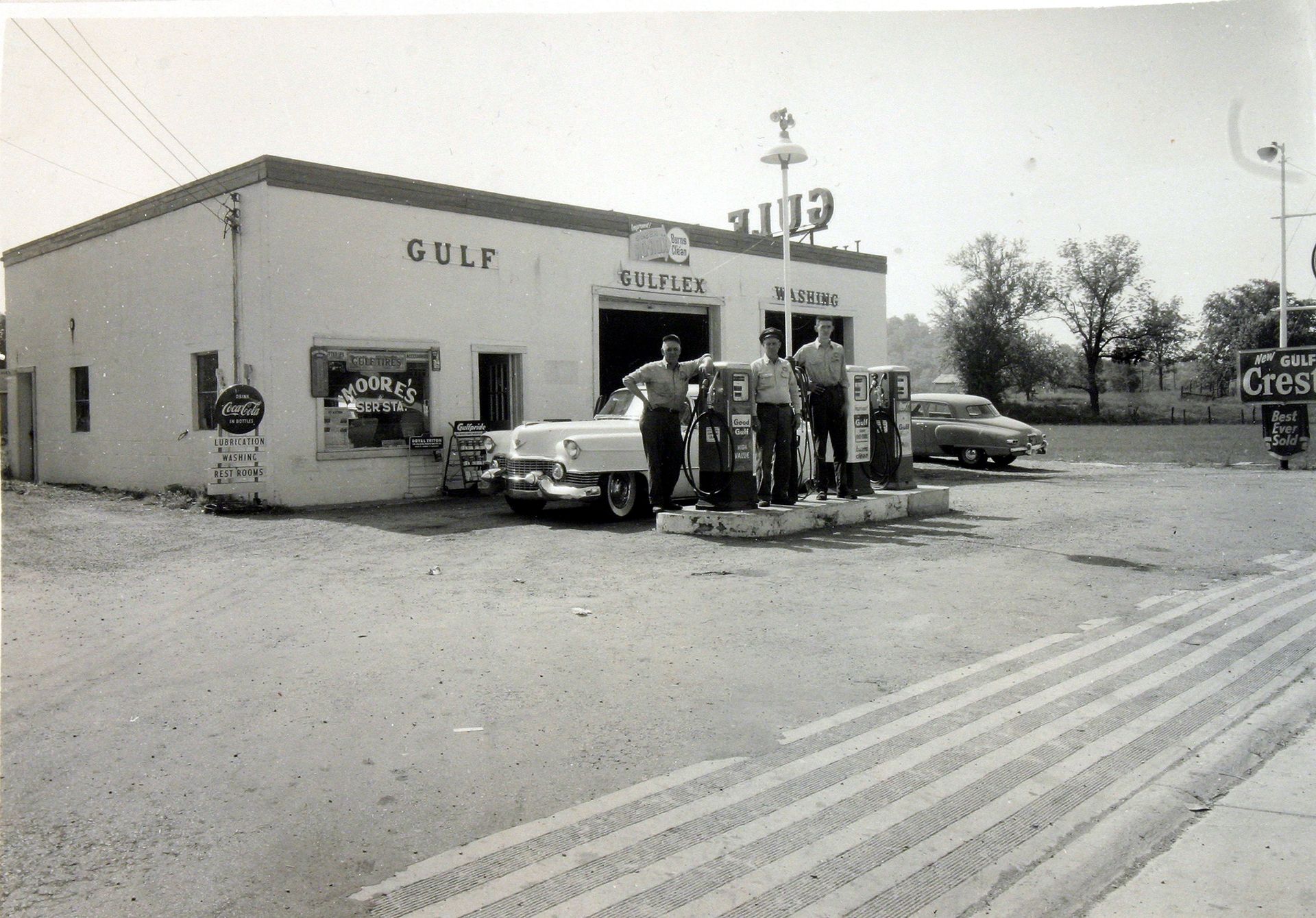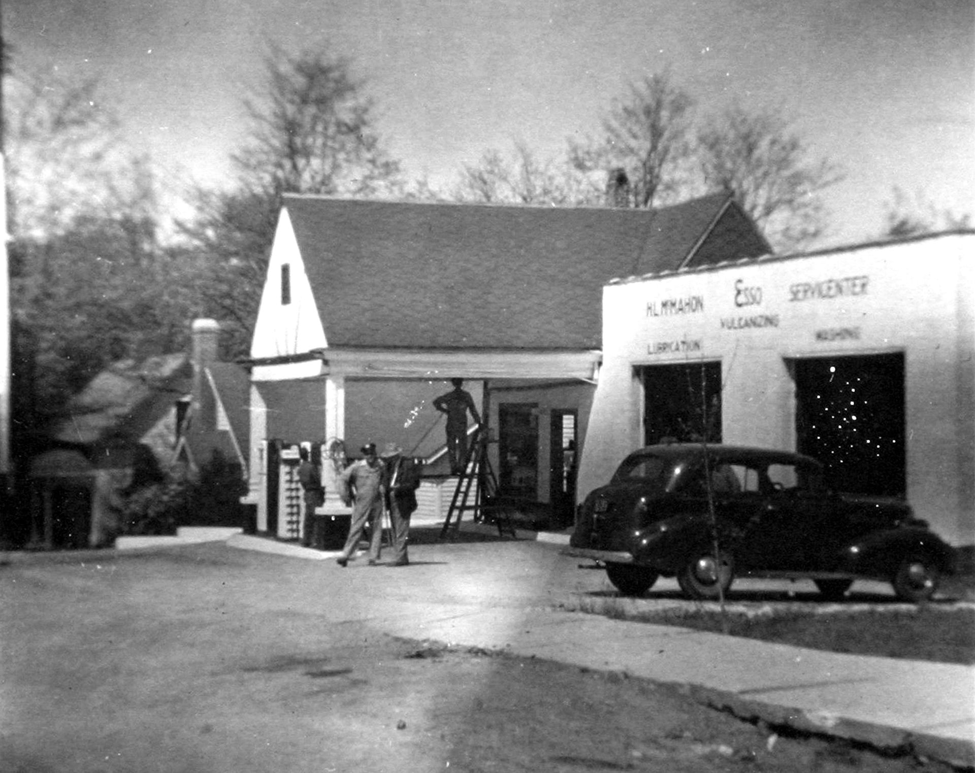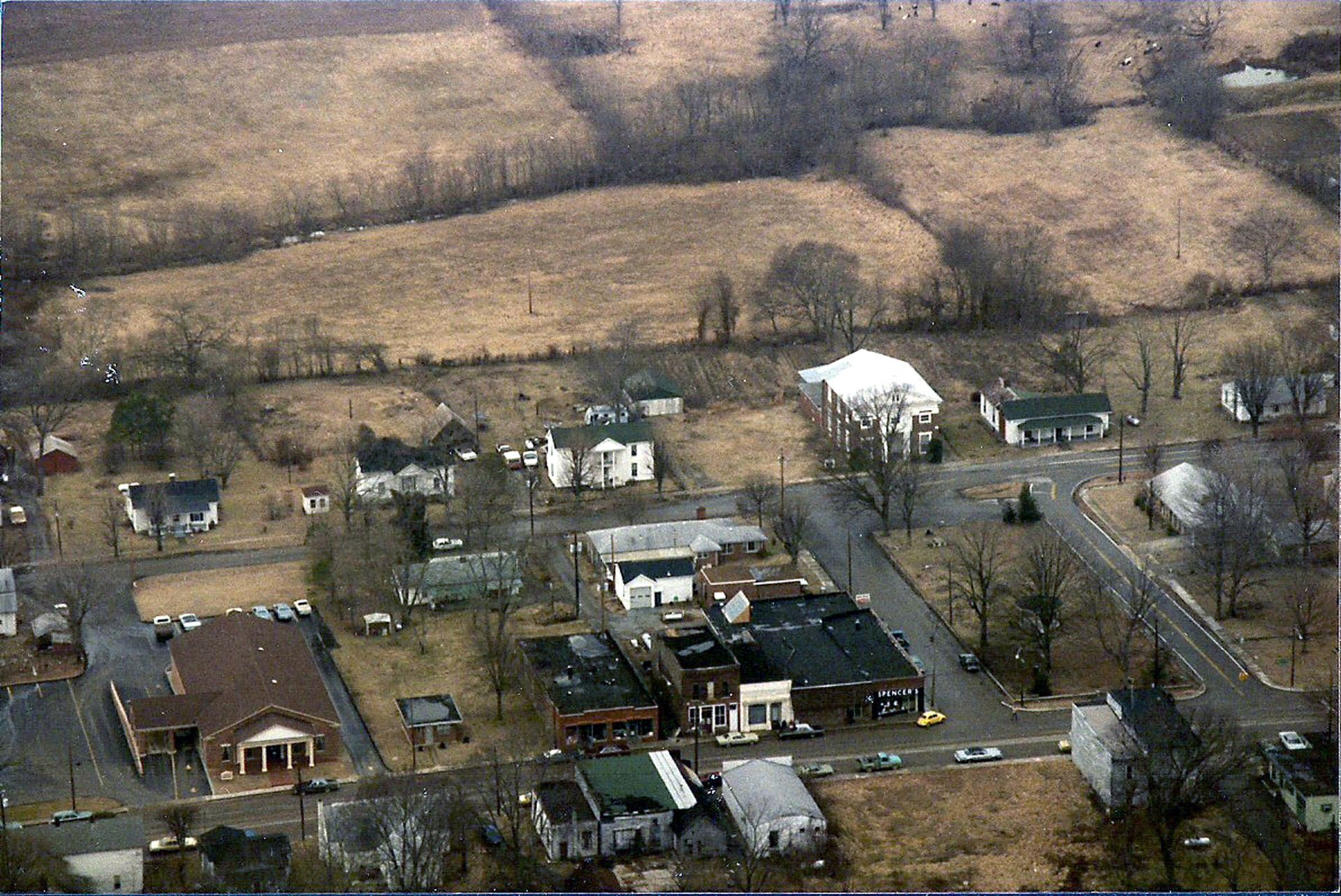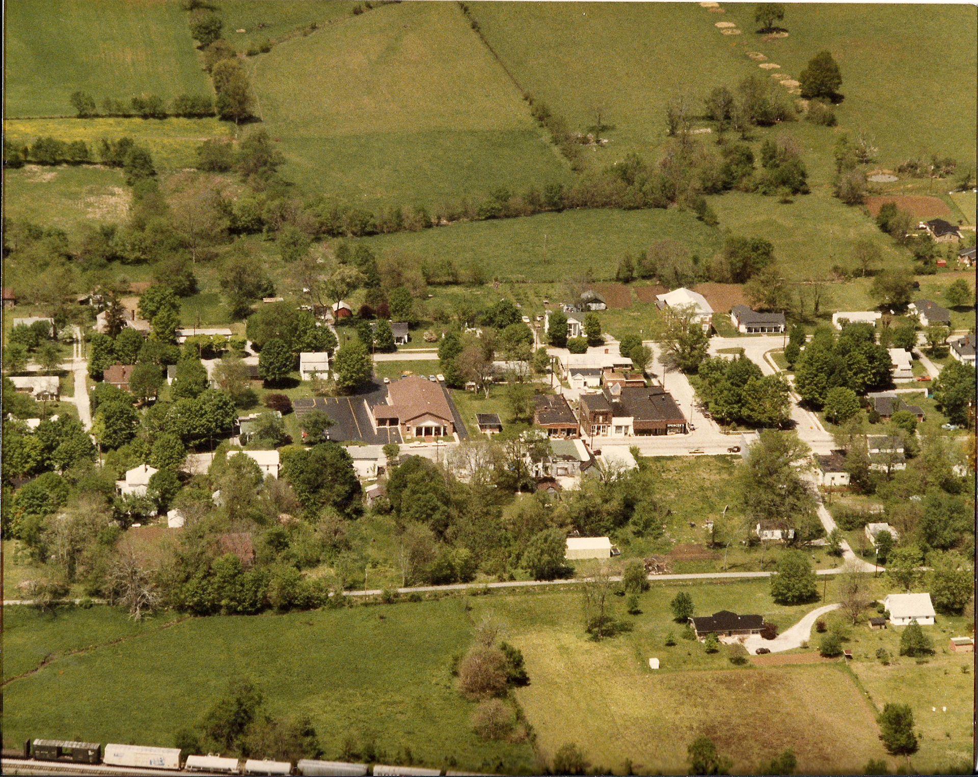
Town of Cornersville
The land upon which Cornersville is situated and the surrounding area was a grant of 5,000 acres from North Carolina to John Nelson who sold the land in 1796 to which was on Robertson’s Creek and Richland Creek to David McRee of Mecklenburg County, NC for 500 pounds in NC currency. David McRee sold 600 acres of this land to James Reed in 1798 and 600 acres to James Conner in 1799. Settlers were eager to move westward but were restricted until the 1805 treaty was reached with the Chickasaw Indians.
Around 1807, settlers began to arrive in the area by way of the McCutcheon Trail, which followed the ridges and avoided the heavy canebrakes in the valley. It began near Spring Hill in Williamson County and ended in the Brick Church area of north Giles County passing about three miles to the west of the site of Cornersville. From the trail, it was necessary for the settlers to cut their way through the thick stand of cane to the sites of the settlements.
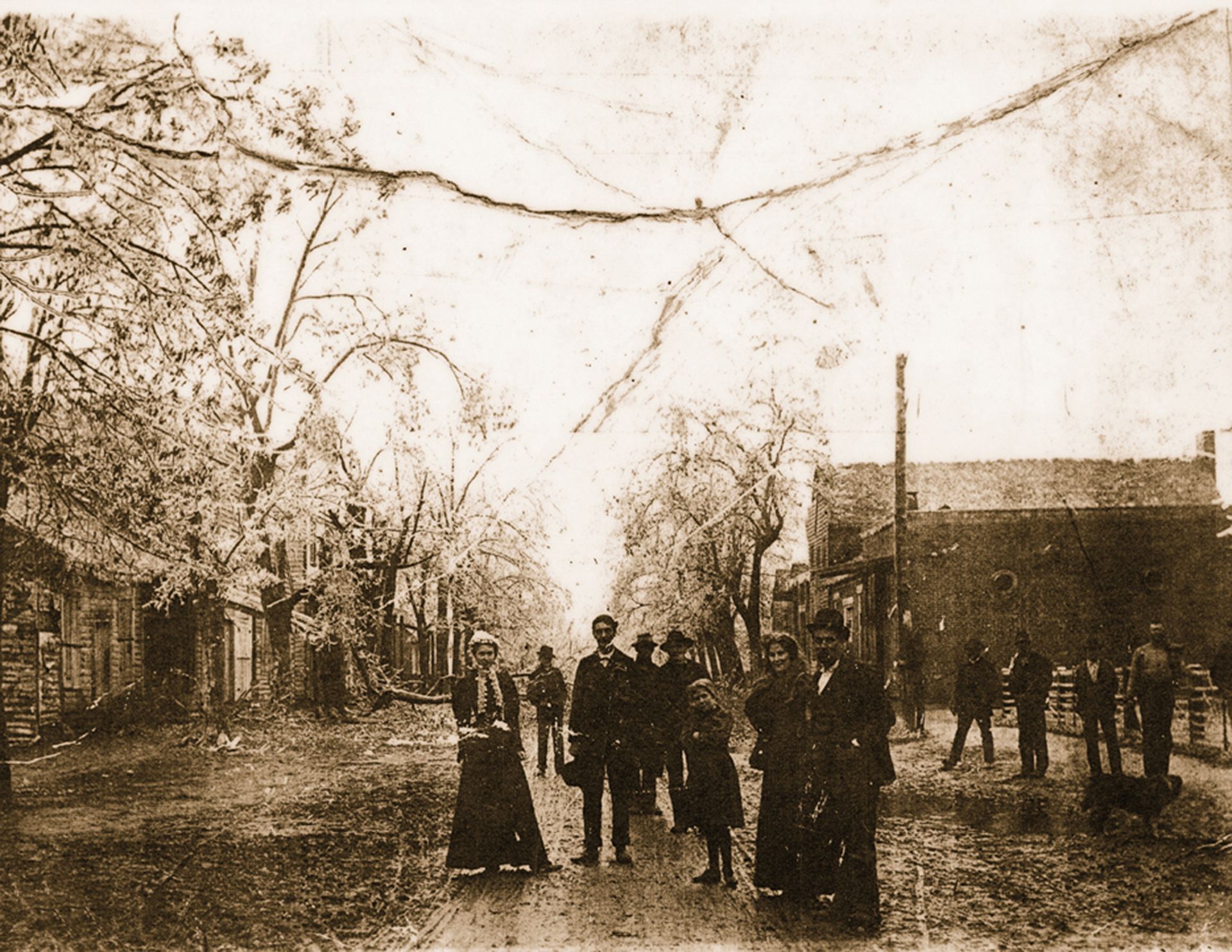
John Haynes was the first settler in the Cornersville area that was originally named “Marathon”. He began clearing a tract of land in 1807. In 1808, William Henderson made a clearing in what would become the business district of Cornersville and built a house.
Before 1820, James, John, and Andrew Haynes, John and William Henderson, Thomas and William Alexander, Joseph Nance, William M. Marr, Richard Stewart, Joseph Armour, Andrew Sprat, Ephriam Patrick, Presley Cox, John Dabney, John Cockrell, and John and Thomas Walker purchased parts of those original 5,000 acres. The corners of the four counties – Bedford, Giles, Lincoln, and Maury met on the 79 acres purchased by John Andrews, which became Cornersville.
Cornersville, “Marathon”, was surveyed and plotted October 9, 1827, by Sam Bigham, a surveyor, and Absalom Alexander, his assistant. The town was named Marathon at the time and was laid out primarily on a farm belonging to William Henderson but encompassed lands belonging to James S. Haynes and others.
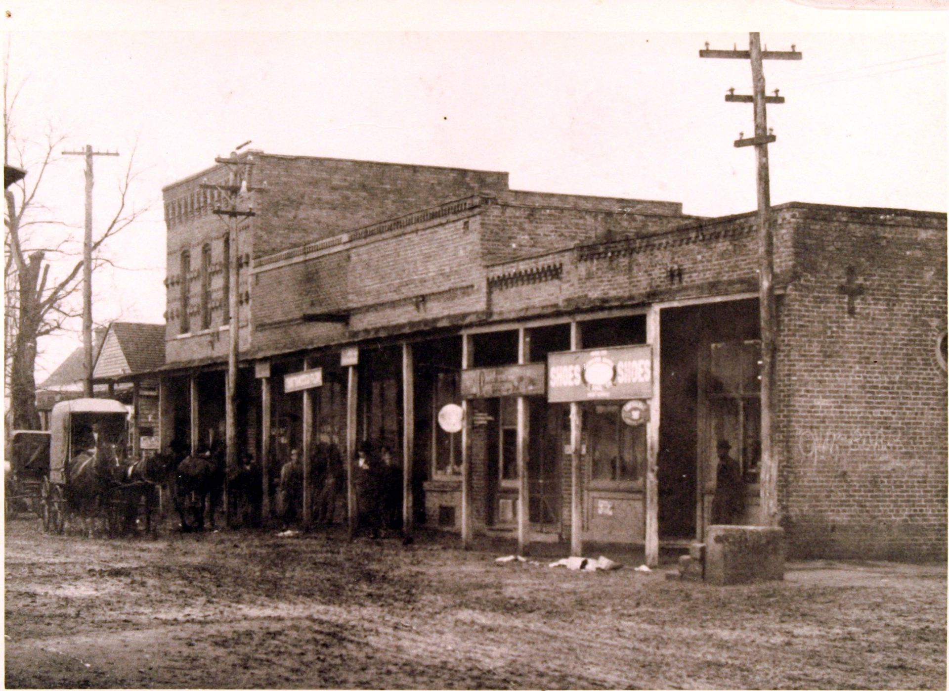
In 1829, William Henderson sold lots number 3, 4, 5, and 6 in the town of Marathon, lying between Main and Mulberry streets, to Massey and Patrick; Lot 15, on the east side of Main Street to Margaret Plaster; Lot 14, south of Lot 15, to Stephen Anderson; and Lot 18 to his daughter, Mary C. Henderson. In each transaction, there is a reference to the plan of the town, which states that streets and alleys, the use of the spring lot with waters, and all public lands (the town park) shall forever remain free for all citizens of said town.
In the Private Acts of the State of Tennessee Legislature, the town was incorporated as follows:
An act to establish a town on the lands of William Henderson and others in Giles County reads as follows: Be it enacted by the General Assembly of the State of Tennessee, that a town which has heretofore been laid off by William Henderson, be, and the same is hereby established, and shall be hereafter known by the name of Cornersville, hereby vesting the proprietors or their executors, with full power and authority to conduct and manage the sale of lots, and all other things touching the regulation of said town, in such manner as to them may be deemed proper for the prosperity thereof.
Ephraim H. Foster
Speaker of the House of Representatives
Joel Walker
7 January, 1830 Speaker of the Senate
Marshall County’s meridian line runs a little more than a mile west of Lewisburg. Prior to the formation of Marshall County (in 1836), this line was the county line between Maury, and Bedford Counties. On this meridian line was located the point at which the corners of Bedford, Giles, Lincoln, and Maury Counties met. This meeting of the corners at the toll gate lot (Lot 52) in Cornersville inspired the name of that town. When Marshall County was formed, the corner was moved to a tree some distance south by the transfer of land from Lincoln to the new county.
This corner was again moved south when the 17th Civil District was severed from Giles County (in 1870) and added to Marshall County.
An act to incorporate the Town of Cornersville, in the county of Giles. Be it enacted by the General Assembly of the State of Tennessee, that the Town of Cornersville and the inhabitants thereof, residing in the following bounds, viz: Beginning at Sarah Cox’s line (widow of Presley Cox), where Mulberry Street intersects said line, thence South including said street, to the Pulaski Road, thence East to James C. Haynes’ line, thence North to Baldridge’s Southwest corner, thence East to said Baldridge’s Southeast corner, thence North to Hollman R. Fowler’s line, thence with said Fowler’s and said Sarah Cox’s line to the beginning, be and they are hereby constituted a body politic and corporate by the name of and the Mayor and Aldermen of the Town of Cornersville, under the same rules, regulations, and restrictions, and to possess the same powers and privileges as the town of Pulaski in the county of Giles; provided, always that said corporation shall from time to time be subject to all such laws as shall be passed by the General Assembly to regulate its concerns.
F.W. Huling
Speaker of the House of Representatives
Burlhet Douglass
28 November, 1831
The 17th District of Giles County became the 17th District of Marshall County on July 1, 1870. The annexation was marked by a torch light ceremony. Sixteen couples riding white horses, representing the sixteen districts of Marshall County, rode out to welcome a couple also riding white horses, representing the old 17th District of Giles County, and welcomed them into the new 17th District of Marshall County.
An Act to Change the County Line Between the Counties of Giles and Marshall was passed 30 June 1870 and approved 1 July 1870…..be it enacted, etc…..That the territory of Giles County lying north and east of the line beginning on the top of the ridge in Giles and Marshall County line, at the west end of Enoch Smith’s farm, not far from Wesley Griffiss’; running thence, in a southern direction with a lane, to the Bear Creek Church road; thence with said road to the mouth of the lane in the Cornersville and Lynnville road that divided the farm of P.T. Cox and Richard Wilkes; thence south with the Cornersville and Lynnville road to a large popular in the road where the Cornersville and Lynnville road turns east; thence with the old Huntsville and Columbia road to the Christian Church near D.G. Ussery’s, the same being the line of the seventeenth districts of Giles County; thence with the said Huntsville and Columbia road and the civil district line, to what is known as the G.W. Day farm and Easlick’s mills; thence east, so as to strike the line that divides the lands of S.G. Marsh and W.W. Simons, near the Cornersville and Pulaski turnpike; thence east with said Marsh and Simmons line to the southeast corner of said Marsh’s farm; thence north to the middle of Richland Creek; thence east up Richland Creek, meandering the same to the point where the Giles and Marshall County line crosses the creek near James Moore’s, shall be, and the same is hereby attached to and constitute a part of Marshall County. In 1870 all 32 square miles of the “Old Cornersville District” were added to Marshall County.
Around 1807, settlers began to arrive in the area by way of the McCutcheon Trail, which followed the ridges and avoided the heavy canebrakes in the valley. It began near Spring Hill in Williamson County and ended in the Brick Church area of north Giles County passing about three miles to the west of the site of Cornersville. From the trail, it was necessary for the settlers to cut their way through the thick stand of cane to the sites of the settlements.
John Haynes was the first settler in the Cornersville area that was originally named “Marathon”. He began clearing a tract of land in 1807. In 1808, William Henderson made a clearing in what would become the business district of Cornersville and built a house.
Before 1820, James, John, and Andrew Haynes, John and William Henderson, Thomas and William Alexander, Joseph Nance, William M. Marr, Richard Stewart, Joseph Armour, Andrew Sprat, Ephriam Patrick, Presley Cox, John Dabney, John Cockrell, and John and Thomas Walker purchased parts of those original 5,000 acres. The corners of the four counties – Bedford, Giles, Lincoln, and Maury met on the 79 acres purchased by John Andrews, which became Cornersville.
Cornersville, “Marathon”, was surveyed and plotted October 9, 1827, by Sam Bigham, a surveyor, and Absalom Alexander, his assistant. The town was named Marathon at the time and was laid out primarily on a farm belonging to William Henderson but encompassed lands belonging to James S. Haynes and others.
In 1829, William Henderson sold lots number 3, 4, 5, and 6 in the town of Marathon, lying between Main and Mulberry streets, to Massey and Patrick; Lot 15, on the east side of Main Street to Margaret Plaster; Lot 14, south of Lot 15, to Stephen Anderson; and Lot 18 to his daughter, Mary C. Henderson. In each transaction, there is a reference to the plan of the town, which states that streets and alleys, the use of the spring lot with waters, and all public lands (the town park) shall forever remain free for all citizens of said town.
In the Private Acts of the State of Tennessee Legislature, the town was incorporated as follows:
An act to establish a town on the lands of William Henderson and others in Giles County reads as follows: Be it enacted by the General Assembly of the State of Tennessee, that a town which has heretofore been laid off by William Henderson, be, and the same is hereby established, and shall be hereafter known by the name of Cornersville, hereby vesting the proprietors or their executors, with full power and authority to conduct and manage the sale of lots, and all other things touching the regulation of said town, in such manner as to them may be deemed proper for the prosperity thereof.
Ephraim H. Foster
Speaker of the House of Representatives
Joel Walker
7 January, 1830 Speaker of the Senate
Marshall County’s meridian line runs a little more than a mile west of Lewisburg. Prior to the formation of Marshall County (in 1836), this line was the county line between Maury, and Bedford Counties. On this meridian line was located the point at which the corners of Bedford, Giles, Lincoln, and Maury Counties met. This meeting of the corners at the toll gate lot (Lot 52) in Cornersville inspired the name of that town. When Marshall County was formed, the corner was moved to a tree some distance south by the transfer of land from Lincoln to the new county.
This corner was again moved south when the 17th Civil District was severed from Giles County (in 1870) and added to Marshall County.
An act to incorporate the Town of Cornersville, in the county of Giles. Be it enacted by the General Assembly of the State of Tennessee, that the Town of Cornersville and the inhabitants thereof, residing in the following bounds, viz: Beginning at Sarah Cox’s line (widow of Presley Cox), where Mulberry Street intersects said line, thence South including said street, to the Pulaski Road, thence East to James C. Haynes’ line, thence North to Baldridge’s Southwest corner, thence East to said Baldridge’s Southeast corner, thence North to Hollman R. Fowler’s line, thence with said Fowler’s and said Sarah Cox’s line to the beginning, be and they are hereby constituted a body politic and corporate by the name of and the Mayor and Aldermen of the Town of Cornersville, under the same rules, regulations, and restrictions, and to possess the same powers and privileges as the town of Pulaski in the county of Giles; provided, always that said corporation shall from time to time be subject to all such laws as shall be passed by the General Assembly to regulate its concerns.
F.W. Huling
Speaker of the House of Representatives
Burlhet Douglass
28 November, 1831
The 17th District of Giles County became the 17th District of Marshall County on July 1, 1870. The annexation was marked by a torch light ceremony. Sixteen couples riding white horses, representing the sixteen districts of Marshall County, rode out to welcome a couple also riding white horses, representing the old 17th District of Giles County, and welcomed them into the new 17th District of Marshall County.
An Act to Change the County Line Between the Counties of Giles and Marshall was passed 30 June 1870 and approved 1 July 1870…..be it enacted, etc…..That the territory of Giles County lying north and east of the line beginning on the top of the ridge in Giles and Marshall County line, at the west end of Enoch Smith’s farm, not far from Wesley Griffiss’; running thence, in a southern direction with a lane, to the Bear Creek Church road; thence with said road to the mouth of the lane in the Cornersville and Lynnville road that divided the farm of P.T. Cox and Richard Wilkes; thence south with the Cornersville and Lynnville road to a large popular in the road where the Cornersville and Lynnville road turns east; thence with the old Huntsville and Columbia road to the Christian Church near D.G. Ussery’s, the same being the line of the seventeenth districts of Giles County; thence with the said Huntsville and Columbia road and the civil district line, to what is known as the G.W. Day farm and Easlick’s mills; thence east, so as to strike the line that divides the lands of S.G. Marsh and W.W. Simons, near the Cornersville and Pulaski turnpike; thence east with said Marsh and Simmons line to the southeast corner of said Marsh’s farm; thence north to the middle of Richland Creek; thence east up Richland Creek, meandering the same to the point where the Giles and Marshall County line crosses the creek near James Moore’s, shall be, and the same is hereby attached to and constitute a part of Marshall County. In 1870 all 32 square miles of the “Old Cornersville District” were added to Marshall County.